This is a reprint of a “From the Local History Room” column that first appeared in January 2015, before the launch of this weblog.
The origin of Pekin’s crazy streets
The From the Local History Room column on Nov. 5, 2011, discussed the question, “Who came first to Pekin?” While delving in Pekin’s early history to answer that question, the column also included the following aside on “why Pekin has such crazy streets”:
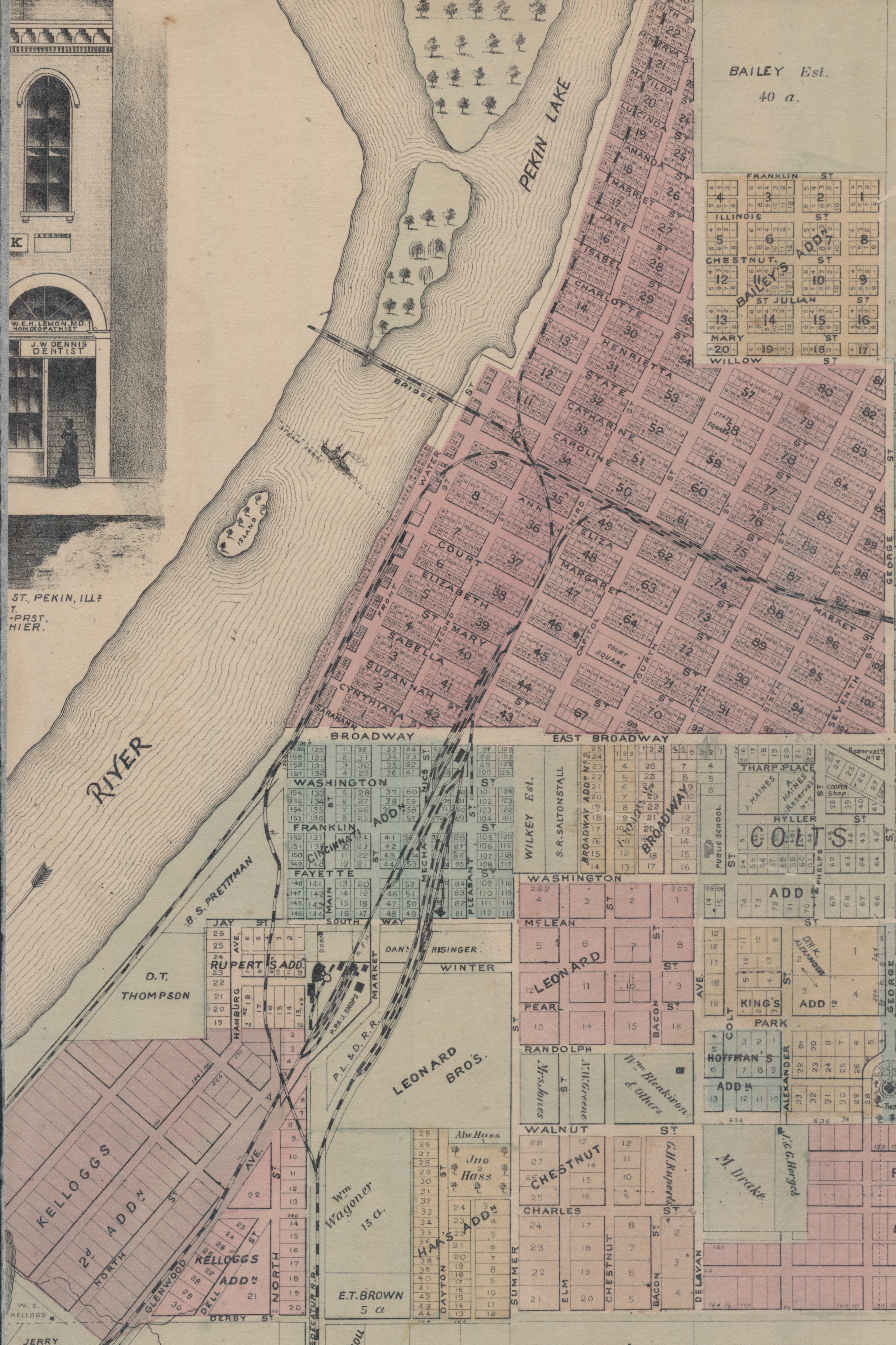
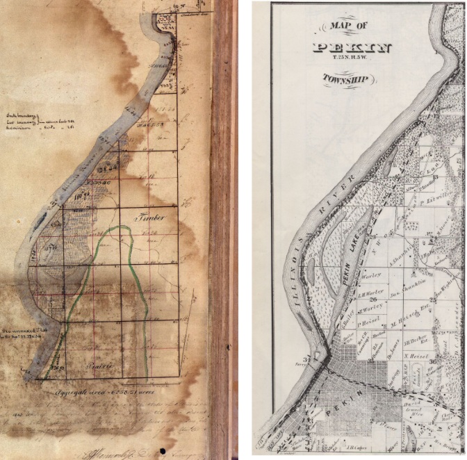
“After the Tharps other settlers would soon arrive – by 1830, what would become Pekin counted eight settlers. The Tharps and their companions, most of them from Ohio, made plans for a village called Cincinnati, with streets to be laid out on a north-south-east-west grid. But other settlers living to the north of the Tharps plotted out a town (named Pekin by Ann Eliza Cromwell) with streets running perpendicular to the Illinois River. The name Cincinnati was given to one of the county’s townships, and the proposed village of Cincinnati was incorporated into Pekin . . . .”
A somewhat more extended account of the origin of the peculiar street plan of the oldest parts of Pekin may be found in the 1974 Pekin Sesquicentennial volume, on page 23:
“A discussion of the development of Pekin’s streets and sidewalks will follow, but first it seems appropriate to attempt an explanation – especially for newcomers – of the unusual mixture of triangular intersections, jogs, and other odd features of the layout of city streets.
“In 1831 (after the land auction in Springfield discussed in the Overview) two rival land-owning groups plotted their ground next to each other, using different layouts. One plotted the town of ‘Cincinnati,’ using a strict north/south grid; the second group plotted the town of ‘Pekin,’ following the line of the Illinois River bank, which resulted in a northeast/southwest grid.
“Other land owners who acquired their property after the 1829 land auction did not develop their holdings into lots immediately. When they did (during the mid-1830s), they followed the north/south grid established by ‘Cincinnati.’ Broadway, which following the grid system of Cincinnati, separated the two original street systems. Court Street was the only thoroughfare extending out of ‘Pekin’ into ‘Cincinnati’; the intersection of this northwest/southeast street with ‘Cincinnati’s’ north/south ones accounts for many of the confusing intersections west of Eighth Street.”
The Sesquicentennial’s account of the origin of Pekin’s street layout notes that it was after the county seat was moved from Mackinaw to Pekin in the summer of 1831 that the town of Cincinnati was formally added to the town of Pekin by an act of the Illinois General Assembly – thereby ensuring the consternation of generations of future drivers.
