Our survey of the unincorporated communities of Tazewell County, with our focus placed upon the Harvard Hills subdivision in the northwest corner of Washington Township. We’ll also take an overview of the township’s various subdivisions and unincorporated communities both past and present.
Washington Township, the second largest township in Tazewell County, has pioneer roots that reach back to the very beginnings of Tazewell County. One of the county’s first settlers of European origin was William Holland Sr., who arrived in Peoria in 1820 and then moved to the future Washington Township in the spring of 1825, when he built a log cabin on Section 23. That was the seed of the city of Washington, which Holland formally laid out and platted in 1834.
Since that time, Washington has always been not only the primary community in Washington Township, but, until East Peoria began to spread east, the township’s only incorporated community. In fact, for much of the township’s early history the city of Washington was the township’s only community. Early plat maps from 1864, 1873, and 1891 show the wide township with Washington in its center and the remainder of the township lightly peppered with schoolhouses and churches.
By 1891, the plat map shows Pekin Junction as a station a few miles somewhat northeast of Washington. The station was where the Atchison, Topeka & Santa Fe Railroad, coming up from the south, joined up with the northeasterly-bound Toledo, Peoria & Western Railway. Pekin Junction, established in 1872 according to the late Fred Soady’s list of Tazewell County toponyms, was named because the Atchison, Topeka & Santa Fe line (originally the Chicago & St. Louis) branched off at that point and headed toward Pekin. The old plat maps do not indicate that any community grew up around Pekin Junction, however.
While the 1891 plat map of Washington Township does not show any other place names besides Washington city and Pekin Junction, it does indicate that the city of Washington was then surrounded by numerous smaller lots that were essentially subdivisions even if not formally laid out as such. The same map also shows three other similar groupings of lots, in Sections 3, 22, and 28.
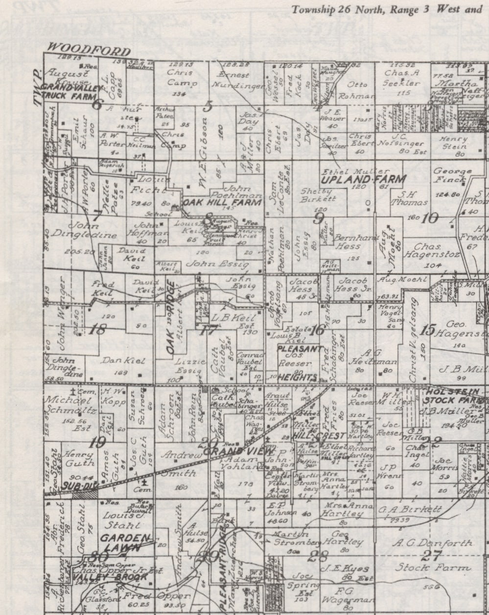
By 1929, in addition to the lot groupings of Section 3 and Section 28, several named subdivisions and farms are scattered all over the plat map of Washington Township: Pleasant Heights, Pleasant Ridge, Forrest View, Grand View, Garden Lawn, Oak Ridge, etc. The lot grouping in Section 3, with north-south strips of land along Liberty Lane, is still there today.
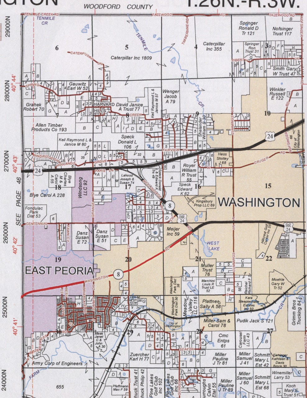
More recent plat maps of the township show the creation of new subdivisions that circled the city of Washington or in the eastern and southern parts of the township. In time, however, most of those subdivisions would be formally annexed either by the city of Washington or the city of East Peoria. One of them, Sunnyland, is now more or less split between Washington and East Peoria. Similarly, the expansion of East Peoria led to the old communities of Gardena and Cloverdale in northeastern Groveland Township becoming a part of East Peoria.
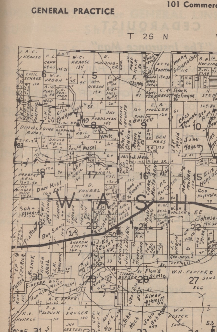
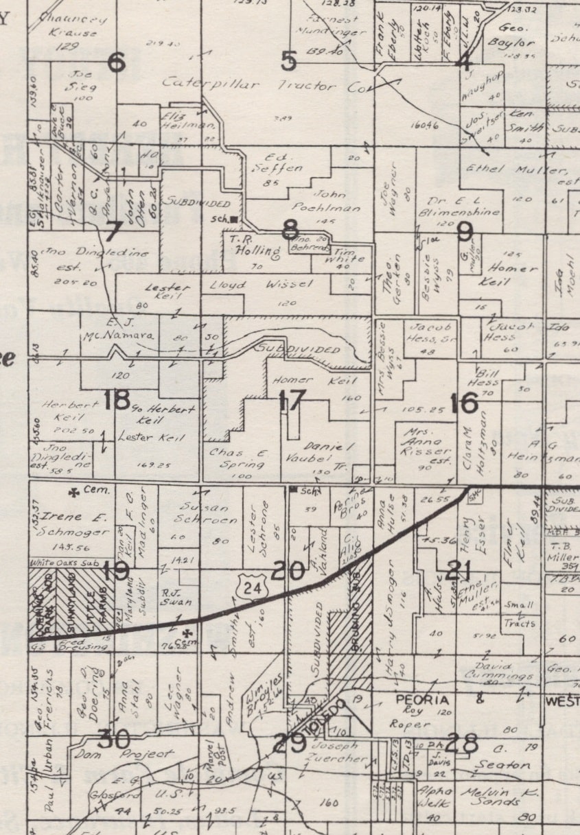
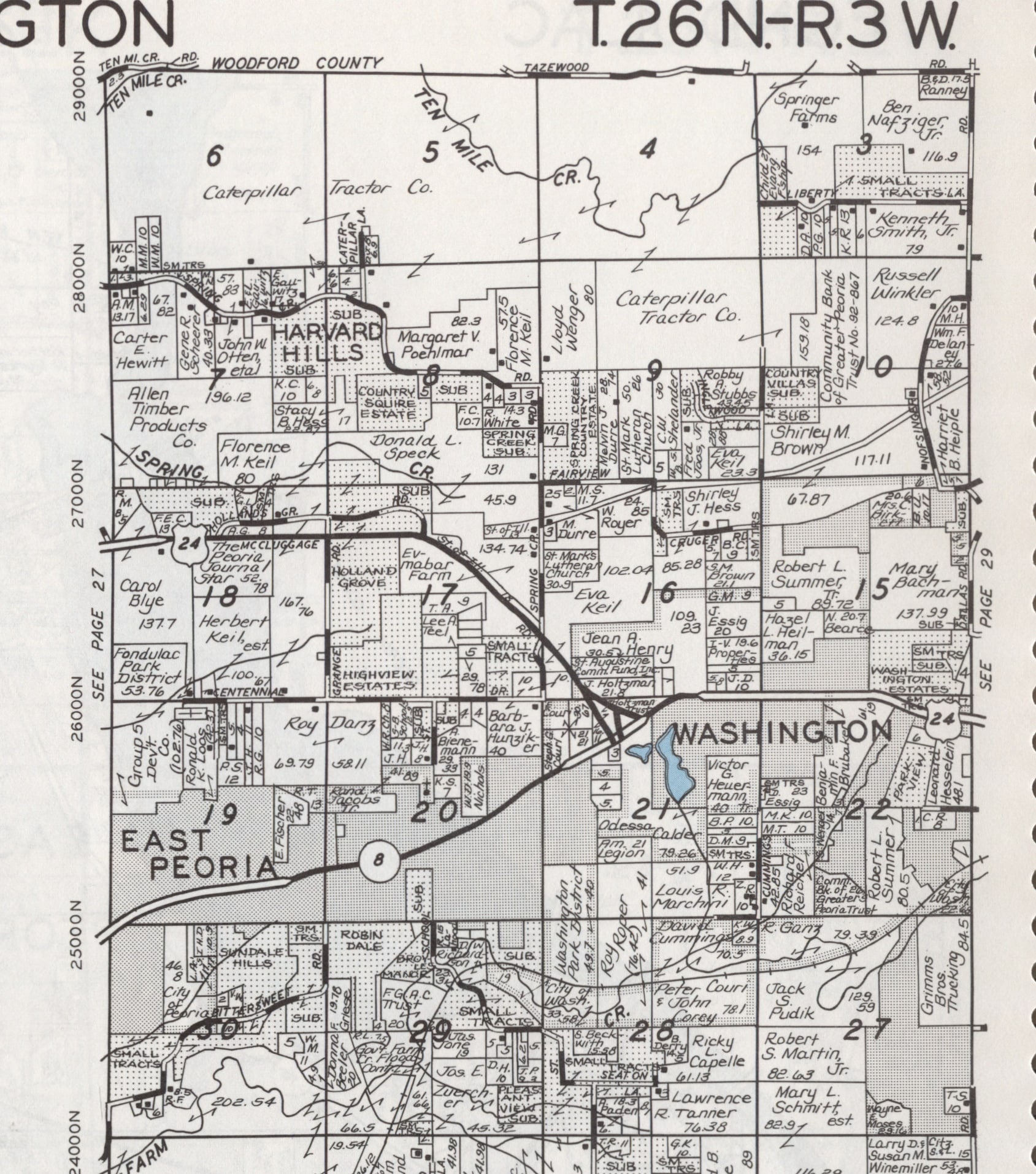
Several unincorporated subdivisions remain in Washington Township, including the homes along Parkview, Camelot, Sunset, Golfview, Woodbine, and Durham that are completely surrounded by the city of Washington. But the largest and most prominent of the named subdivisions in the township is Harvard Hills in Sections 7 and 8, in the northwestern corner of Washington Township. The homes of Harvard Hills lay along Hillman Street, North and South Behrens Avenue, Green Avenue, and Spring Creek Road.
The 1864 and 1873 plat maps show that much of the land of Harvard Hills was then owned by members of the Ficht family. Another earlier landowner in the area, as shown on the 1891, 1910, and 1929 plat maps, was John Poehlman. A country school once existed on Ficht land in Section 8, adjacent to Poehlman’s farm. In more recent times, a prominent owner of the future land of Harvard Hills was Charles Rinkenberger, as shown on the 1945 plat map of Washington Township.
By 1955, however, Rinkenberger’s land (on which the old country school was still situated) is shown on the map as “subdivided” – the genesis of Harvard Hills.
