As we continue our series on Tazewell County’s unincorporated communities, this week we return to Cincinnati Township to visit a location that is now little more than a name on the map: the former rural village of Stoehrs.
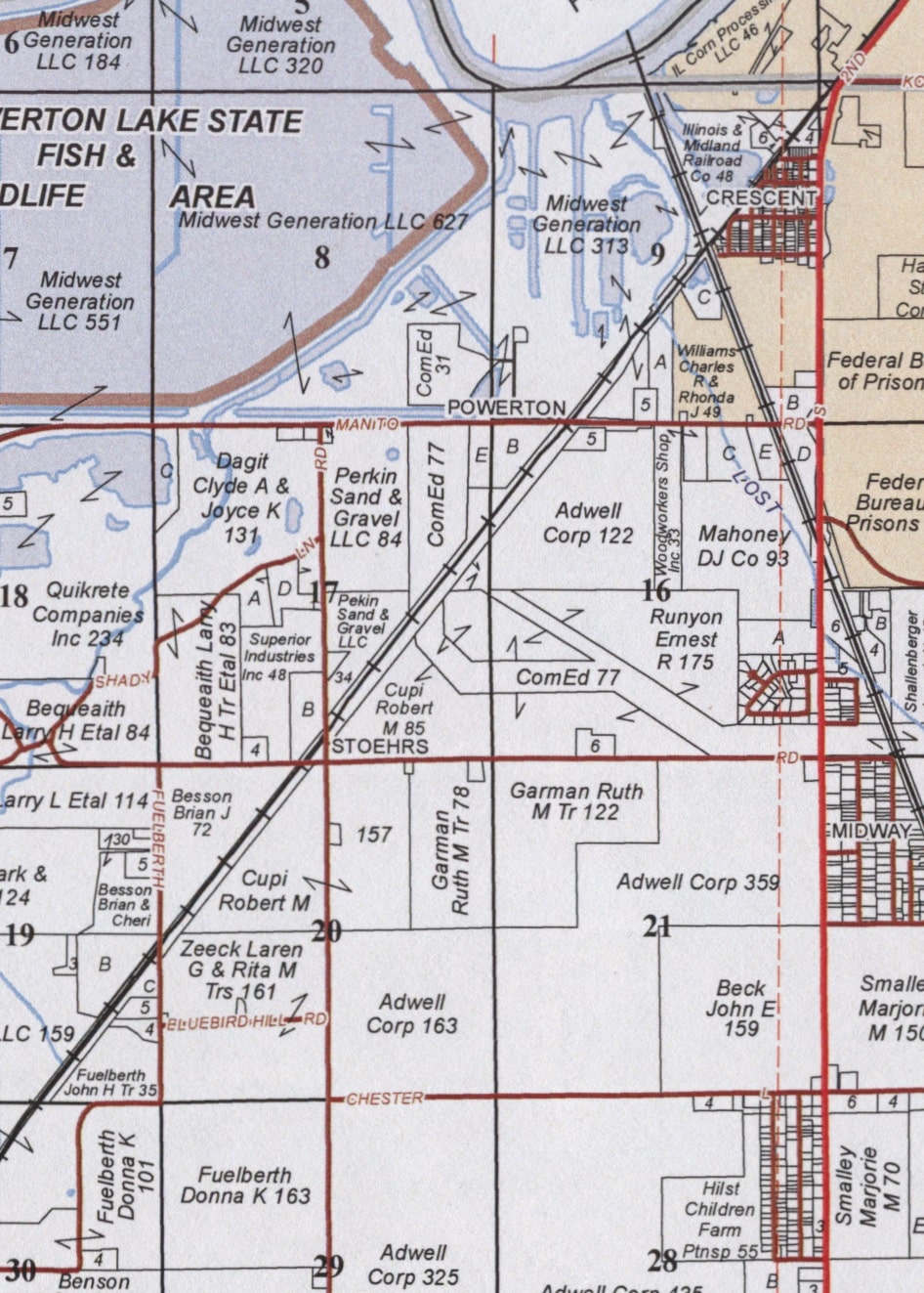
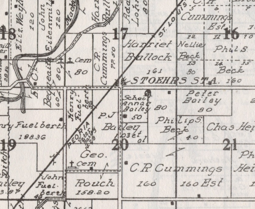
Stoehrs, sometimes called Stoehrs Station, is straight west of Midway, being situated adjacent to the intersection of Wagonseller and Garman roads in northwestern Cincinnati Township. John Drury’s 1954 “This is Tazewell County,” page 61, offers this brief comment on Stoehrs:
“Another community in Cincinnati Township is Stoehrs. It is a small village on the Chicago & Illinois Midland Railroad and lies just northwest of the Pekin Airport. The village is served by the post office at Pekin.”
In his 1979 “Preliminary Master List of Settlements in Tazewell County, Illinois,” the late Fred Soady tersely described Stoehrs as “station J. – S. E. next south of CRESCENT – P.O. 1882-1887 (north of Hainesville).” This means Stoehrs had its own post office from 1882 to 1887. Stoehrs originated as a depot on the old Peoria, Pekin & Jacksonville Rail Road (which became the Chicago, Peoria & St. Louis before it became the Chicago & Illinois Midland).
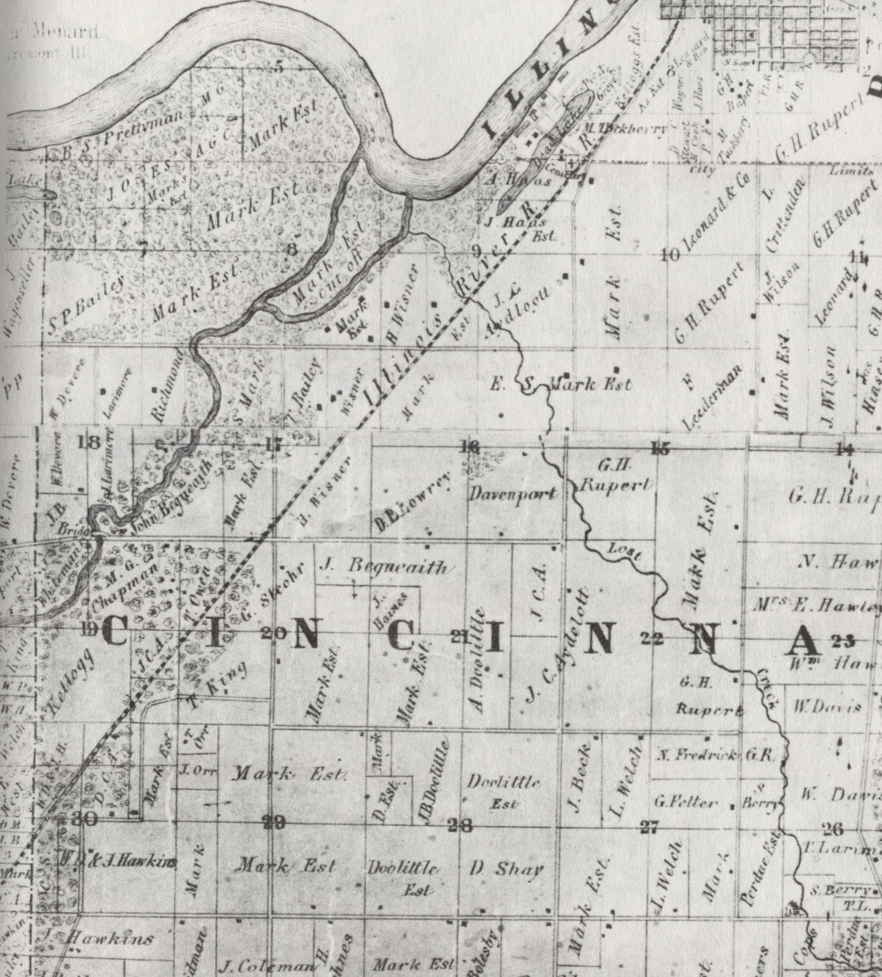
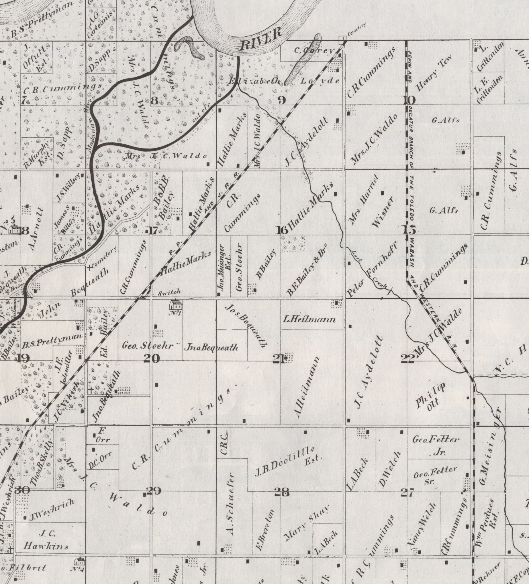
Stoehrs got its name because it was established on the farm of George Stoehr (1852-1911), whose homestead was about a quarter of a mile south of the Wagonseller-Garman Road intersection. The site of George Stoehr’s homestead is still the location of the home place of a farm, on land owned by Robert Cupi.
In the past a country schoolhouse (Cincinnati Township’s School House No. 1) was a quarter mile east of the intersection on Garman Road. The children of farming families in the vicinity of Stoehrs would attend that school. Today there are a few farm homes just to the east of Stoehrs on Garman Road, near where the school used to be, while a very short jog west of Stoehrs on Garman is the Marine Corps League.
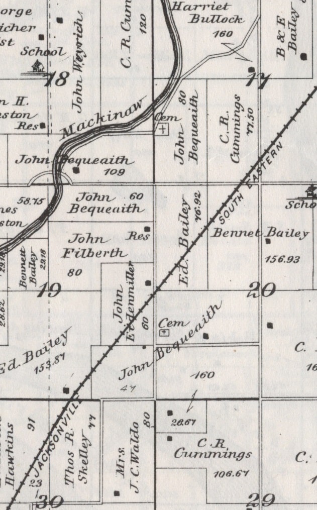
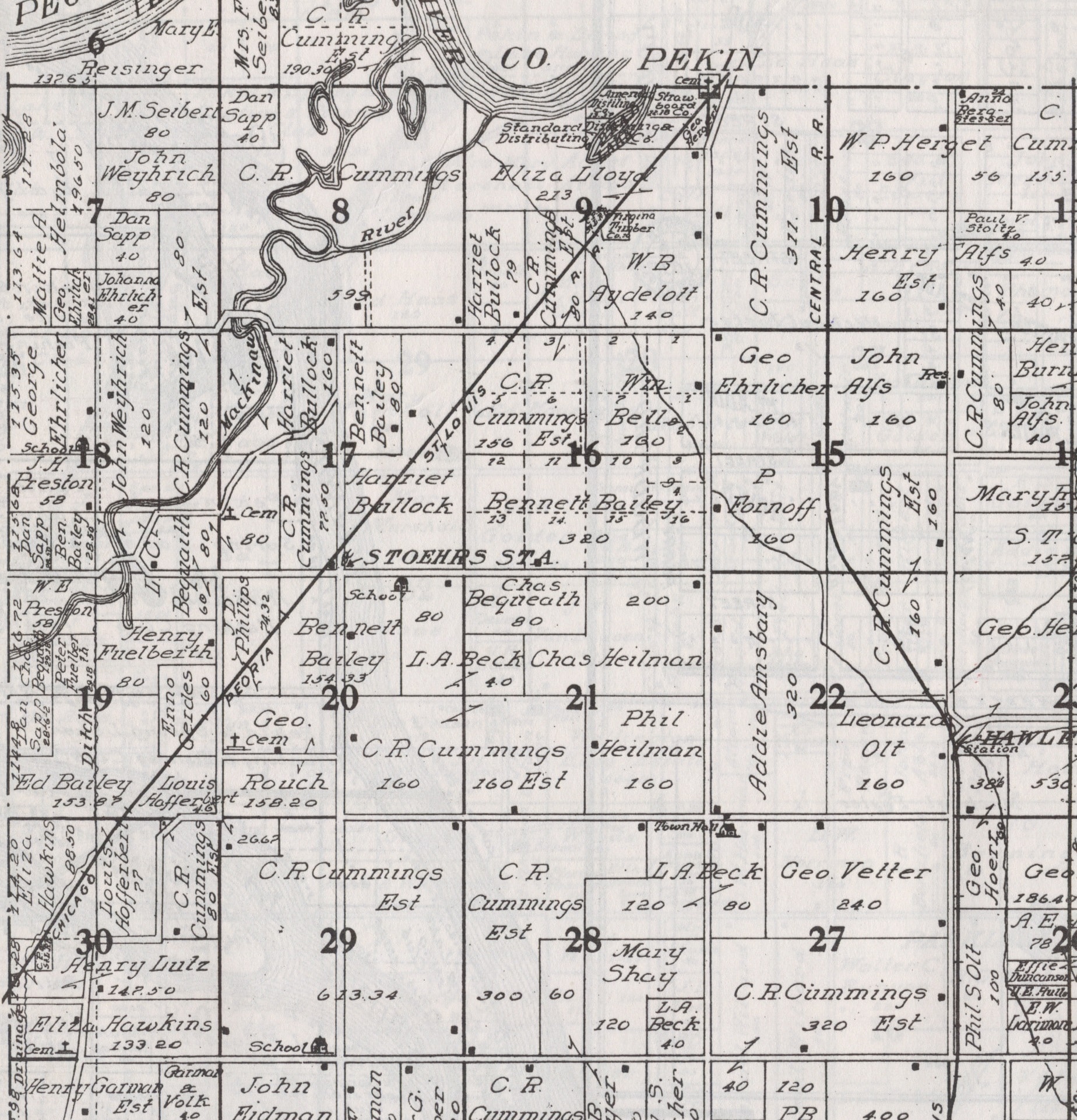
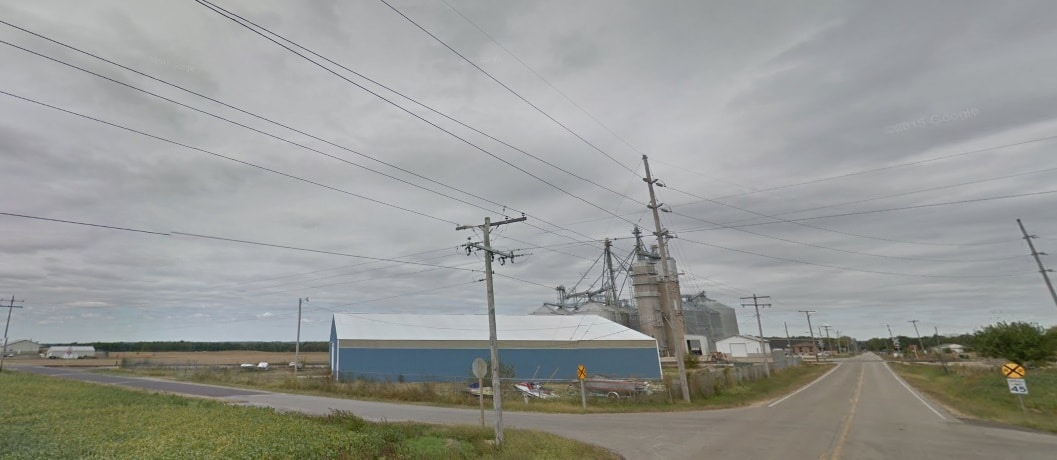
That about does it in the way of residences near the Stoehrs Station intersection. The railroad still runs through, but the train station, the post office, and the school are long gone. The spot today is chiefly an area for agriculture and industry. Tremont Cooperative Grain’s elevators on Wagonseller Road are on the north side of the Stoehrs railroad crossing. Just a bit further north up Wagonseller are Superior Industries Inc. and Excel Foundry & Machine.
Two pioneer cemeteries are located close to Stoehrs. Southwest of Stoehrs, at the northeast corner of Fuelberth and Bluebird Hill roads, is King Cemetery, a burying ground where members of the King, Clark, and Shaw families were interred from 1843 to 1881.
Off to Stoehrs’ northwest is Bequeath Cemetery (also called Bequaith or Bequeaith Cemetery) on the meandering country road that more recently has been known as Excel Way (because it connects with Wagonseller where Excel Foundry & Machine is located). Bequeath Cemetery was established on the land of a pioneer farmer named John Bequeath (1820-1893), and he and many of his kin are buried there.
Incidentally, the reason that Excel Way meanders is because the road originally tracked the bends and curves of the Mackinaw River. The winding creek to the west of the road formerly was the channel by which the waters of the Mackinaw River found their way to the Illinois River from the mid-1800s to the mid-1900s, until the Mackinaw changed its course and made itself a new river mouth (as it has done in the past).


