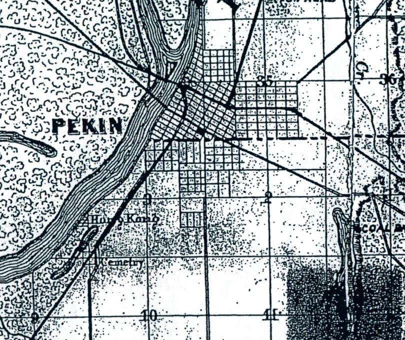
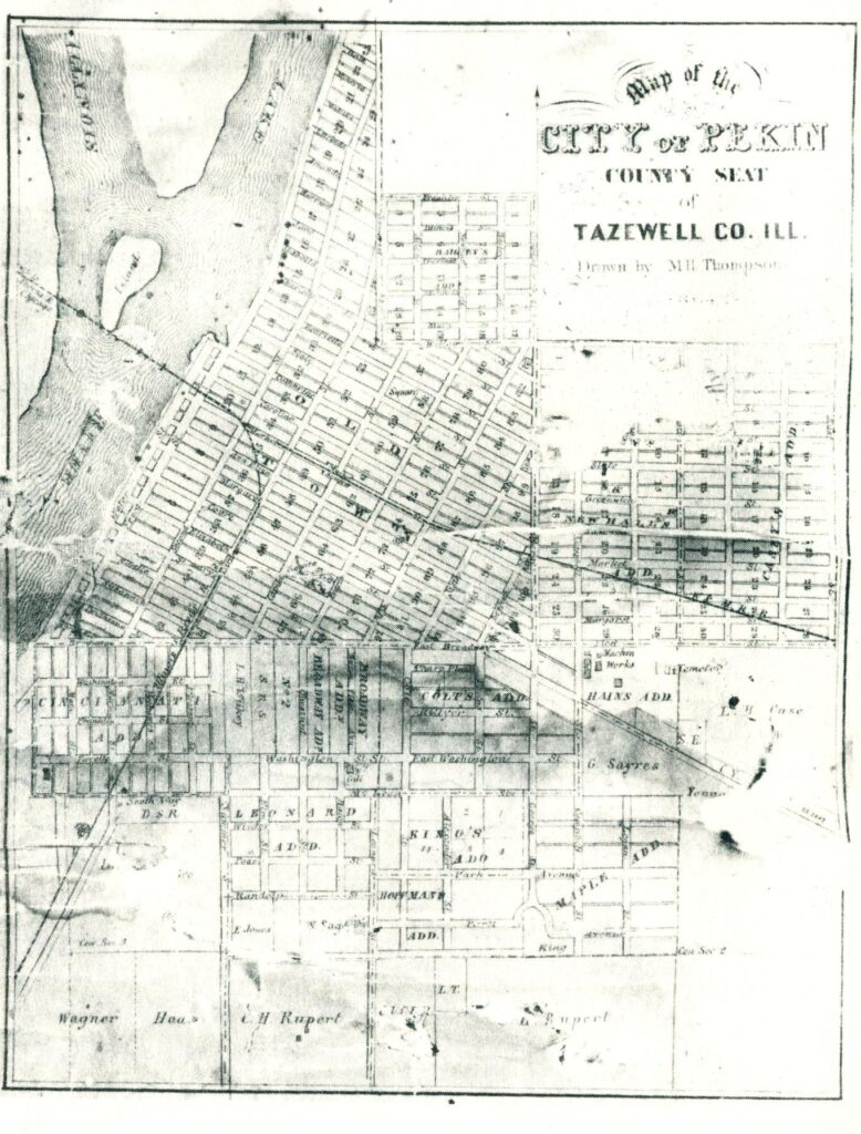
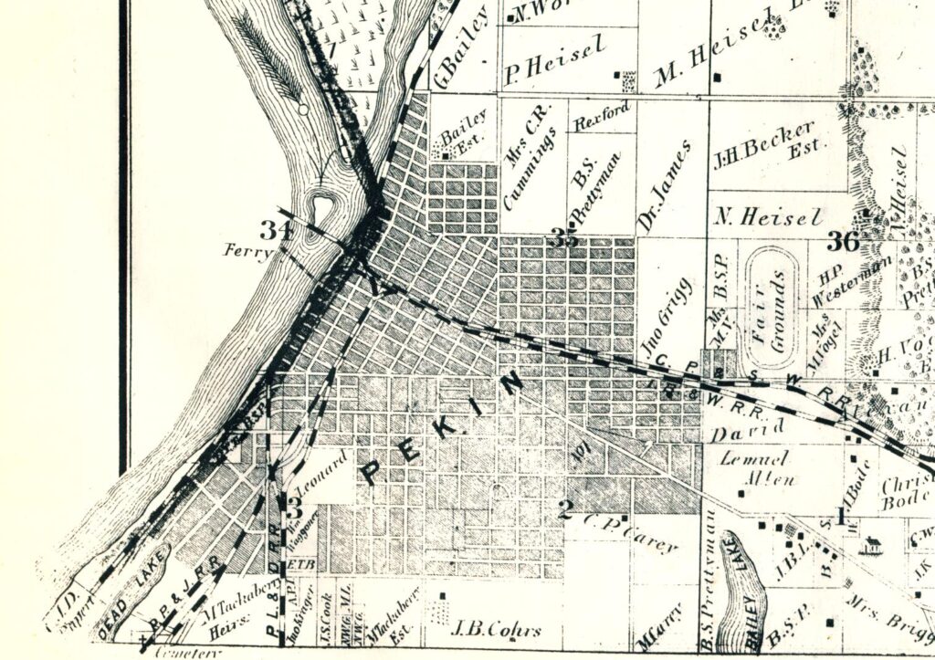
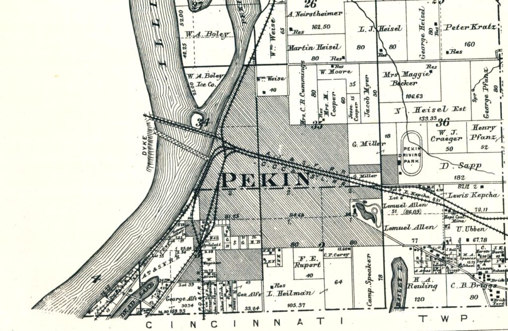
Among the Pekin Public Library’s Local History Room resources available for study are a series of old atlases featuring maps of the Townships, municipalities, and settlements of Tazewell County.
As we noted last week, apparently the earliest known wall map of Tazewell County was produced in 1857, just three decades after Jonathan Tharp built his log cabin at a spot on a bluff above the Illinois River, the location that is today the foot of Broadway. That wall map may be examined at the Tazewell County Genealogical & Historical Society, while editions of the later published maps and atlases are available in the Pekin Public Library’s Local History Room.
A few years later, in 1864, another large plat map of Tazewell County was produced. The 1864 plat map was the subject of a From the Local History Room column that appeared in the March 8, 2014 Pekin Daily Times. In 1979, the Tazewell County Genealogical & Historical Society prepared a copy of the 1864 map for publication in a single volume that also includes the 1873 “Atlas Map of Tazewell County, Illinois” and the 1891 “Plat Book of Tazewell County, Illinois.”
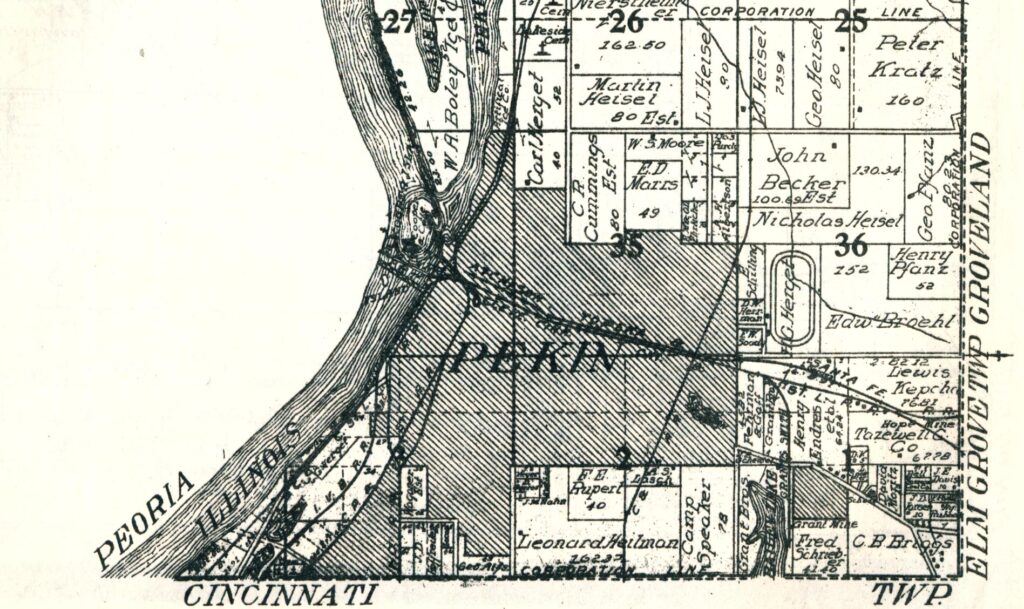
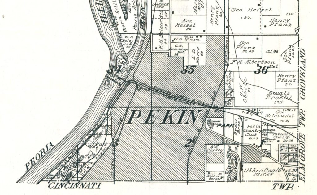
A third TCGHS-commissioned reprint of old county atlases includes the 1910 “Standard Atlas of Tazewell County, Illinois,” and also bring us down to 1929, with that year’s edition of the “Standard Atlas” and county plat book.
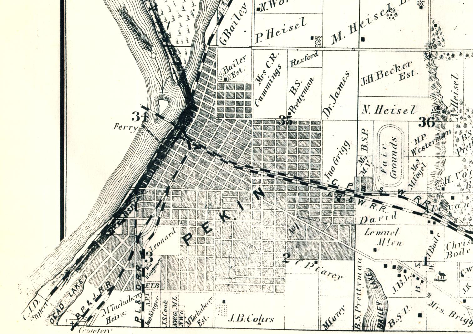
As a convenient example of the value of old maps and atlases, we may consider the growth of the city of Pekin from the time of the 1857 map down to 1929. In 1857, the streets of Pekin extended no further north than the area where North Second and Sommerset streets meet, no further south than Walnut Street, and no further east than 14th Street (then called East Street). Pekin’s streets in 1864, in the last full year of the Civil War, showed little if any change – but the city limits themselves extended to what is today Sheridan Road on the north, what is today 17th Street on the east, and what is today Koch Street on the south (those three streets did not then exist, however). Just beyond the city limits on the east was a large horse race track, something not shown on the 1857 map.
By 1873, however, Pekin’s street grid had stretched a bit further south – Derby Street was then the city’s southernmost street, while on the east the grid extended as far as Primm and Christopher streets – short north-south roadways that no longer exist, but which used to be in the general area where Coal Car Drive today cuts through Mineral Springs Park. The northernmost streets were Ruth Street (a little cul-de-sac that no longer exists, just north of the junction of Second and Sommerset) and Franklin Street (today called Amanda). That horse race track outside Pekin’s eastern city limits was then designated the “Fair Grounds of the Pekin Agricultural & Mechanical Association,” occupying 80 acres along the north side of Broadway near 18th Street (see From the Local History Room, Pekin Daily Times, Jan. 18, 2014).
The street layout of Pekin in 1891 had not expanded greatly beyond its 1873 extent, but on the east the gridwork shot out an arm or two as far as the border of Daniel Sapp’s “Pekin Driving Park,” then the name of the old horse race track. Less than two decades later, however, the atlas in 1910 shows a grid of streets in the southwestern corner of town reaching as far as Koch Street – the neighborhood of Cooper, Herget and Sapp streets. Nearby to the east, South Capitol, South Fourth, Bacon, and South Fifth streets extended as far as South Street. On the southeast of Pekin, a new subdivision south of Court Street appeared near the northwest shores of Bailey Lake (later called Lake Arlann, now called Meyers Lake). On the east, a full grid of streets reached as far as 17th Street and north to Willow Street. The race track was still there, but the “Pekin Driving Park” was then on land owned by H. G. Herget and was operated by the Pekin Trotting Association.
The 1929 atlas shows additional growth, with added subdivisions south of Court Street and east of Bailey Lake, an impressive, broad swath of new streets between Derby and Koch streets and east of South Fifth, and a new subdivision north of Willow Street and east of Eighth on part of the old Cummings estate. There still were no named or numbered streets beyond 17th on the east, however, but the race track was no more – adjacent to the former race track property was the entrance to the old Grant Coal Mine.
The photo gallery here features Pekin maps from the above mentioned maps, atlases, and plat books.
